The First Russian Antarctic Expedition was led by the Russian Imperial Navy officer Fabian von Bellingshausen, along with Mikhail Lazarev, from 1819 to 1821. The sloop Vostok was under the command of Bellingshausen, while Lazarev commanded the sloop Mirny. Overall, the crew consisted of 190 people. This expedition was notable for being one of the earliest to reach Antarctica and is heralded by many as the first to sight the Antarctic continent on 27 January 1820.
The expedition made many discoveries and sighted several islands in the region, including Peter I Island and Alexander I Island. Bellingshausen and his crew successfully circumnavigated the continent, making significant contributions to the mapping and understanding of Antarctic geography. The expedition also made observations of the Antarctic coastline, icebergs, and wildlife, providing valuable scientific data for subsequent explorations and studies of the continent. Of the expedition’s 751 days, 527 were spent at sea; the total length of the route was 49,860 nautical miles. For 127 days, the expedition was above 60 degrees south latitude.
James Cook’s voyages in the late 18th century, particularly his exploration of the Southern Ocean and the Antarctic Circle, laid foundational knowledge about the existence and general characteristics of the Antarctic region. Cook’s reports and maps provided a basis for subsequent explorers, including Bellingshausen. His voyage purposefully complemented Cook’s circumnavigation of Antarctica by covering the regions not reached by Cook. When Cook had gone north, Bellingshausen went south, and vice versa.
Both Cook and Bellingshausen placed significant emphasis on scientific observations during their voyages. Both expeditions were known for their meticulous recording of natural history, meteorology, and oceanography.
The achievements and discoveries of Bellingshausen’s Antarctic expedition were published in Russian in 1831 in two volumes, with accompanying drawings in an atlas. In 1842, a short report was published in Germany, and in 1945, a full English translation of Bellingshausen’s only book was edited by polar explorer Frank Debenham and released.

The Antarctic Peninsula has been a focal point for scientific research since the early 20th century. This research has evolved from initial exploratory missions to comprehensive scientific studies. In the early 1900s, several expeditions began to explore and study the Peninsula region, including those led by de Gerlache, Charcot, Nordenskjöld, and Shackleton. These expeditions made major contributions to the mapping and naming of the region, as well as scientific advances in geology, meteorology, ecology, biology, and more.
In 1957–1958, the International Geophysical Year—also referred to as the third International Polar Year—was launched. This collaborative international effort marked a significant leap in Antarctic research. Numerous countries established research stations on the continent, leading to extensive data collection on the Antarctic Peninsula. It also marked the end of a long period during the Cold War when scientific exchange between East and West had been seriously interrupted. Since that time, science has been the central focus of all human activity in Antarctica, and international collaboration continues to define much of the work achieved in the region, with organizations like the Scientific Committee on Antarctic Research (SCAR) facilitating cooperation in scientific endeavors.
Many early studies focused on the geological history of Antarctica, including rock formations and fossil records, revealing that the Peninsula was once part of the supercontinent Gondwana. Extensive research on glaciers and ice sheets has since provided insights into past climate conditions and ongoing climate change, both in the region and globally. Studies on the unique ecosystems—including penguins, seals, and various forms of marine life—have been crucial. Early biologists documented species distributions and adaptations to the harsh climate. Oceanographic research in the early and mid-20th century mapped the extent and seasonal variations of sea ice, as well as ocean currents around the Peninsula.
All this early research provided the foundation for long-term, time-series datasets in the Peninsula and wider Antarctic, paving the way for modern research to build upon. Initial exploratory and observational studies have now evolved into complex and technologically advanced scientific investigations, providing critical insights into the impacts of rising temperatures on ice melt, sea-level rise, and global climate systems, as well as developments in geology, biology, biogeochemistry, oceanography, and more.
These efforts continue to be essential for understanding global environmental changes and preserving the unique Antarctic ecosystem—particularly in the Antarctic Peninsula, which is one of the fastest-warming regions on Earth.
The highest, coldest, windiest, and driest continent—98% covered in ice—it is of little surprise that Antarctica is also the poorest continent in terms of vegetation diversity. Indeed, it could be considered amazing that any plants manage to survive here at all—yet some do, even in its most inhospitable regions.
Algae
There are around 360 known species of terrestrial or freshwater algae living in Antarctica, the majority of them making their home on rocks. Some, like the species illustrated here, are even more remarkable, as they live in the ice itself. In late summer, entire swathes of ice can appear green, red, or yellow as the algal bloom reaches its peak.
Mosses
Mosses can be found in greatest abundance in some parts of the South Shetland and South Orkney Islands. However, some of Antarctica’s 75 known moss species grow surprisingly far into the continent’s interior, with the southernmost record at 84°42' S.
Lichens
Between 350 and 400 species of lichen are known to exist in Antarctica, reaching as far south as 86°09' S and up to altitudes of 2,000 meters. They come in three main types:
Crustose – These grow as encrustations on rocks, just as their name suggests. One example is Xanthoria elegans, which has a wide global distribution and a preference for cold and extreme environments. It is also found in the Arctic and in some of the world’s highest mountain ranges.
Fruticose – These are more striking in appearance. Some species in the genus Usnea are commonly seen around Neptune’s Window on Deception Island. They are sometimes referred to as "Old Man’s Beard" for obvious reasons.
Foliose – These resemble dried leaves in appearance, as shown by the black material growing among the crustose lichens in the image provided.
Flowering Plants
Only two species of flowering plants are found in Antarctica, both confined to the Antarctic Peninsula and nearby islands.
Antarctic hairgrass (Deschampsia antarctica) is the tallest plant in the region—the "canopy layer" of Antarctic vegetation—though it rarely exceeds a few centimeters in height. It reaches its southern limit at Refuge Islet, 68°21' S.
Antarctic pearlwort (Colobanthus quitensis) is smaller and less widespread, but it can be found nearly as far south as the hairgrass, with its southernmost record on Neny Island at 68°12' S.
As the region continues to warm, it is worth looking out for either of these species at higher latitudes, as their ranges are likely to extend further south.
History
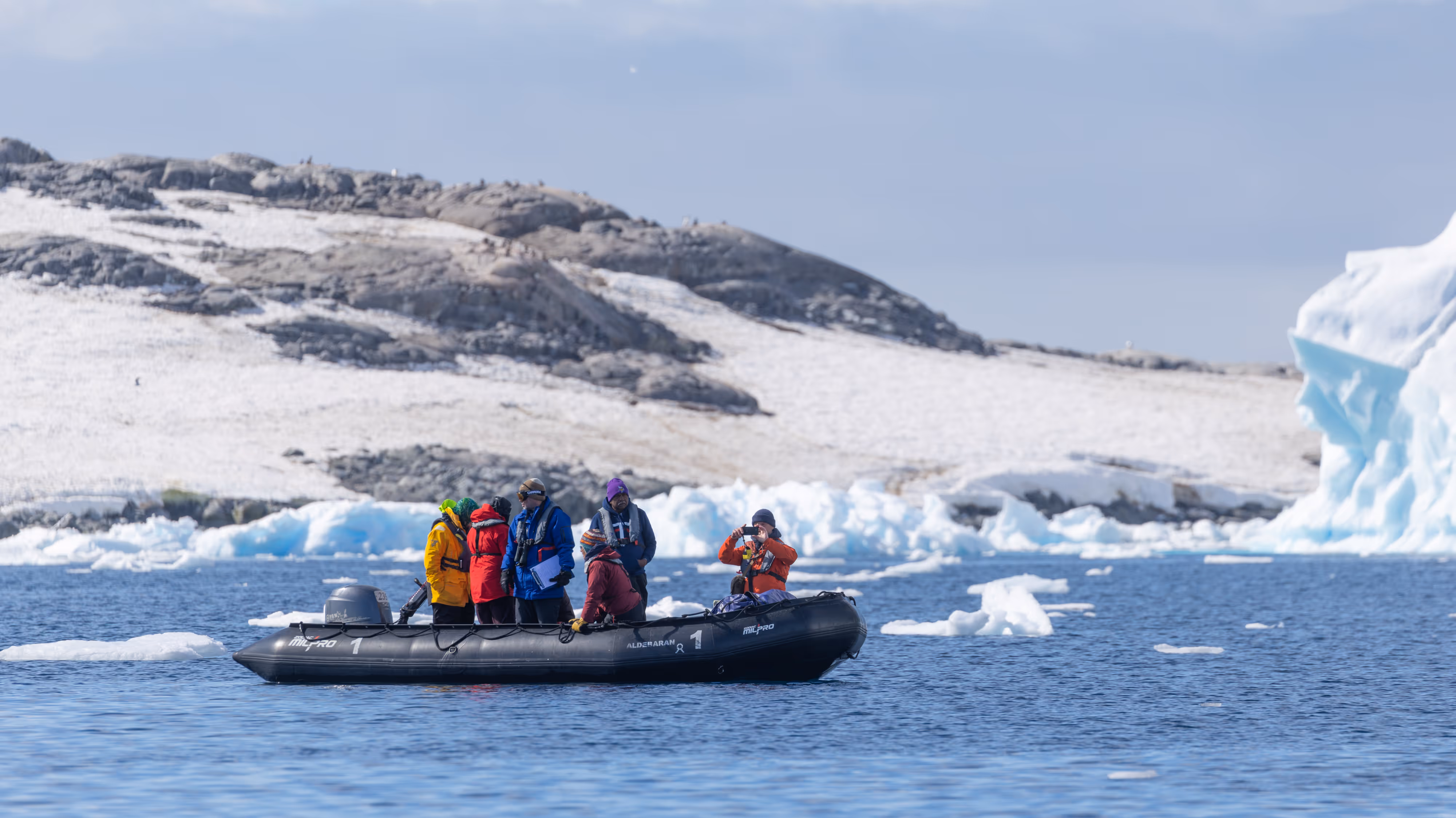
The Bransfield Strait is a body of water about 100 km (60 mi) wide, extending for 500 km (300 mi) in a general northeast–southwest direction between the South Shetland Islands and the Antarctic Peninsula. Today, in summer, ships of all types can be found here: fishing vessels, ships carrying tourists, scientists, or supplies for research stations, and modern-day adventure seekers in small yachts. But 200 years ago, it was a very different story.
The strait was named by James Weddell, Master of the Royal Navy, in 1825. He named it after Edward Bransfield, also a Master in the Royal Navy, who was among the first people to set eyes upon the Antarctic continent itself—not just the offshore islands or ice sheets. His expedition (1819–1820) followed the discovery of the South Shetland Islands the previous year by merchant captain William Smith.
After Smith presented his discovery to British Royal Navy Captain William Henry Shirreff in Valparaíso, Chile, an exploratory expedition was quickly organized to confirm Smith's findings. Shirreff appointed Edward Bransfield as Master and Commander of the ship Williams. The Williams was a small ship of 216 tons and 25 meters in length, with a crew of 29 men. The mission of Bransfield’s expedition was to explore and chart new lands, to "go on a voyage of discovery towards the South Pole," and to find out if any native populations were friendly and willing to trade—an indication of how little was known about Antarctica at that time. The ship was equipped for a 12-month voyage.
Bransfield was not the only person in the region that summer. News of Smith's discovery had also attracted both British and American sealers, as fur seal pelts were extremely valuable at the time. Thus began the South Shetland fur sealing industry. It was highly lucrative during the first season, less so in subsequent years, and all but over within three years. Nonetheless, sealers continued to travel to the region and pushed further south, hoping to discover new stocks of seals to exploit.
The ship captained by Edward Bransfield, the Williams, thus played a key role in early Antarctic exploration.
We may have only known about the existence of the Bransfield Strait for just over 200 years, but of course, it has been there much longer! At least 4 million years ago, the islands of the South Shetlands began to move northwest, away from the Antarctic Peninsula—a process that is still ongoing today—thereby sectioning off the southern part of the Drake Passage, now known as the Bransfield Strait.
If we look at terrestrial environments, we can see mountains, valleys, and plains, shaped over time by glaciers, rivers, volcanoes, and other natural forces. When we look at the sea, however, we tend to see a (comparatively) flat expanse of water. But if all that water were drained away, we would find similar features to those on land—mountains, ridges, valleys, and craters—and recognize the same geological processes at work, continuously shaping the seafloor.
A bathymetric map helps us visualize what lies beneath the waves as we sail to or from the peninsula. As the South Shetlands continue to move northwest, the strait is still widening. In the north-central part of the strait, we find an active volcanic rift located at around 63° S, at depths of 2,000 to 3,000 meters (6,500 to 9,800 feet). The most famous feature in this rift zone is Deception Island.
Looking to the northeast of Deception Island, we find three more submarine volcanoes: The Axe, Three Sisters, and Orca. Although currently considered dormant, all three rise around 600 meters (1,900 feet) above the surrounding seabed. The main craters of the last two volcanoes each span over 2 kilometers (1.2 miles) in diameter.
It is also worth noting that the deepest parts of the Bransfield Strait reach down to about 4,000 meters (13,100 feet) below sea level. For comparison, the highest point in the northern part of the Antarctic Peninsula is Mount Français on Anvers Island (2,825 meters / 9,268 feet), and the highest point in the South Shetlands is Mount Foster on Smith Island (2,100 meters / 6,800 feet). One could argue that the undersea "scenery" is even more dramatic and impressive than what we see above the surface—if only we could see it!

In the early 19th century, British and American sealers and explorers—such as Edward Bransfield and Nathaniel Palmer—charted parts of the Antarctic Peninsula's coastline. These initial maps were rudimentary, focusing mainly on the coastal outlines, as their primary purpose for being in the region was commercial.
During the Heroic Age of Antarctic Exploration (late 19th to early 20th century), more detailed charts and maps were developed by most expeditions that traveled south. For example, the Scottish National Antarctic Expedition (1902–1904), led by William S. Bruce, made significant contributions to the mapping and understanding of the Antarctic region, including the Weddell Sea and the eastern tip of the Peninsula. The Swedish Antarctic Expedition (1901–1904), led by Otto Nordenskjöld, also conducted detailed scientific research and mapping, particularly around the Larsen Ice Shelf.
However, it was the Belgian and French expeditions—led by Adrien de Gerlache and Jean-Baptiste Charcot, respectively—that contributed most significantly to the mapping of the Peninsula during this period. Many of the place names still used today are attributed to these two expeditions.
During the interwar period (1920s–1940s), there was an increase in aerial surveys of the region. The British Graham Land Expedition (1934–1937), led by John Rymill, used traditional sledge-based exploration but also pioneered the use of aircraft for surveying. This resulted in much more accurate maps of the Graham Land region of the Peninsula. The U.S. Antarctic Service Expedition (1939–1941), led by Richard E. Byrd, also utilized aircraft for aerial photography, again improving the accuracy of maps of the coastline and interior.
After World War II and during the International Geophysical Year (1957–1958), aerial surveys and ground mapping became much more systematic and thorough throughout the Peninsula and beyond. The International Geophysical Year (IGY), a major scientific collaboration involving multiple countries, led to comprehensive mapping and data collection across Antarctica. Techniques during this time included seismic sounding, photogrammetry, and extensive ground surveys.
The advent of satellites in the 1960s revolutionized Antarctic mapping. Satellites such as Landsat, Terra, and ICESat have provided high-resolution imagery and elevation data. Geographic Information Systems (GIS) technology has enabled the integration of various data sources into detailed, interactive maps. Organizations like the Scientific Committee on Antarctic Research (SCAR) have developed comprehensive digital mapping databases.
Since the 1980s, GPS has been used for precise location measurements, greatly improving the accuracy of Antarctic maps. More recently, advanced techniques like Synthetic Aperture Radar (SAR) and Light Detection and Ranging (LiDAR) have provided detailed topographical data, which are especially useful in mapping ice sheets, glaciers, and subglacial landscapes.
Through these historical efforts, the mapping of the Antarctic Peninsula has evolved from basic, hand-drawn sketches to highly accurate and detailed representations that serve scientific, logistical, and navigational purposes both on land and at sea.
The Antarctic Circumpolar Current (ACC) carries water around the globe at about 145 million cubic metres per second—a flow equivalent to approximately 150 times the combined flow of all the world’s rivers. The ACC connects the Atlantic, Pacific, and Indian Oceans to form a global network of ocean currents that redistributes heat around the Earth, significantly influencing the global climate.
This massive flow is driven by some of the strongest winds on the planet. The persistent westerly winds—frequently punctuated by gales—led sailors to nickname the southern latitudes the “Roaring Forties” and “Furious Fifties.” The flow of the ACC is concentrated into a number of narrow jets or fronts. The two most important of these are the Subantarctic Front and the Polar Front (also known as the Antarctic Convergence). As water flows from north to south across these fronts, properties such as temperature, salinity, oxygen levels, and nutrient concentrations change rapidly. As a result, the fronts also mark boundaries between distinct biological communities. In fact, early oceanographers could often determine their location in relation to these fronts by the presence or absence of specific species, such as certain types of krill.
The circumpolar connection in the Southern Ocean enables a global-scale circulation system to exist. This circulation transports warm, near-surface water and cold, deep water in alternating directions, resulting in a net redistribution of heat and other properties around the globe. Deep water that upwells closer to Antarctica is cooled by the frigid air blowing off the continent and becomes saltier as brine is released during sea ice formation. This dense water then sinks near Antarctica’s continental margin and flows northward as deep-sea currents along the ocean floor.
Water masses formed in the Southern Ocean spread throughout the world’s oceans. As these water masses sink from the surface, they carry oxygen and carbon dioxide into the deep ocean, helping to renew or “ventilate” it. Without this sinking of dense, oxygen-rich water near Antarctica, deep ocean layers would become severely depleted in oxygen. In this way, the Southern Ocean acts like the “lungs” of the deep sea.
Currently, about one-third of the carbon dioxide produced by human activities is being absorbed by the ocean, slowing the pace of climate change caused by the enhanced greenhouse effect. Of that, roughly 40% is being sequestered in the Southern Ocean, as part of the overturning circulation that draws surface waters—and the gases they contain—into the deep sea. In addition to absorbing gases like oxygen and carbon dioxide, the Southern Ocean also absorbs heat from the atmosphere. This heat is transported from the surface into the ocean interior, contributing to sea-level rise through thermal expansion.